PGS seismic vessel Ramform Vanguard has begun a new multi-azimuth marine seismic survey in the North Sea. This industry-funded project extends the GeoStreamer X area within the Viking Graben by 1160 sq. km. The first data is due Q3 2020.
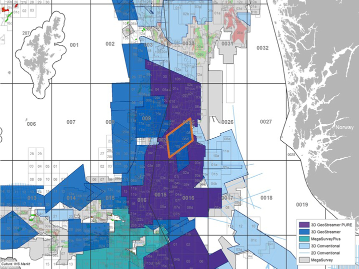
The GeoStreamer X Viking Graben 2020 extension project will again combine three acquisition directions with PGS’ latest technology innovations for advanced offset- and azimuth-rich data. This project builds on the successful 2019 GeoStreamer X pilot project in the same area.
“Our GeoStreamer X Viking Graben pilot clearly demonstrated the positive project economics and the illumination uplift that can be achieved with multi-azimuth GeoStreamer data on NCS. That is why, even in these difficult times, the market is willing to support an extension of the GeoStreamer X coverage area,” says Gunhild Myhr, VP New Ventures at PGS.
Solving Viking Graben Imaging Challenges
The Viking Graben is a prolific hydrocarbon province, however, finding the next discovery is always easier in hindsight and with modern data. Geological challenges in the area are illumination and resolution of potential targets in sand injectites, improved velocities prediction of V-brights, which cause shadow zones underneath, and improved imaging underneath the large, shallow channels.
Migration artifacts generated by a thin and rugose chalk layer predominant in the area are thoroughly suppressed due to due to higher fold and multi-azimuth data in the GeoStreamer X solution, radically improving the signal to noise ratio and the reflection continuity both above and below the chalk.
The Ramform Vanguard will tow 14 streamers, including two 10 km-long tails to provide offsets for FWI, and a wide-tow multisource with a 250 m total separation. This configuration will deliver close to zero offsets, for optimal near-offset sampling and shallow imaging. The setup also provides dense spatial sampling for high-resolution imaging, improved illumination, and offers a significant efficiency gain and reduced environmental footprint compared to node-based exploration.
KeyFacts Energy Industry Directory: PGS*
* Free to view 'Energy Industry Directory' profile information includes; description, services, local and corporate locations and links to 'Linkedin People'.