Critical Resources – Rare Earth Elements
Date: 03 - 05 Jul 2023
Location: Online
Tutor: Holly Elliott, Lecturer at the University of Derby
This course covers all aspects of rare earth elements (REE) as critical resources, both in terms of technological advancement and combating climate change. We shall delve into the major sources of these elements, their tectonic settings and the enrichment processes that lead to deposit formation. The characteristics of major REE deposits shall be investigated, using international case studies, to determine typical exploration methods and factors affecting processing.
You will learn to:
- Understand the characteristics and behavior of REE in these geological environments.
- Understand the geological processes leading to formation of different deposit types.
- Understand and identify the multiple enrichment mechanisms that lead to REE-enrichment.
- Identify typical rocks and minerals associated with REE deposits.
- Evaluate typical features of REE deposits to determine appropriate exploration techniques.
- Interpret geochemical and exploration data associated with REE deposits.
- Assess the economic viability of deposits using typical characteristics.
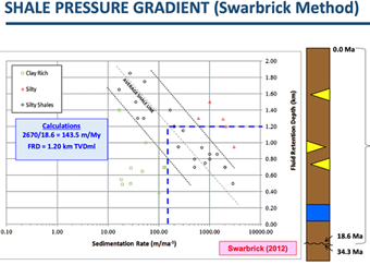
Best Practices in Pore Pressure and Fracture Pressure Prediction
Date: 05 - 06 Jul 2023
Location: Online
Tutor: Richard Swarbrick, Manager, Swarbrick GeoPressure Consultancy
This course presents best practices in how data and standard techniques are combined to generate meaningful pore pressure (PP) and fracture pressure (FG) estimates from log, seismic and drilling data, and to use them to develop pre-drill predictions. The limitations are addressed, along with common pitfalls, leading to an understanding of the uncertainty and risk associated with PP and FG prediction.
You will learn to:
- Distinguish the different types and quality of data which populate pressure-depth and EMW-depth plots for display of pressure predictions and calibration data in well planning.
- Use best practice to create PP estimations and predictions from seismic, log and drilling data using standard porosity-based techniques, and from modeling geological systems.
- Use best practice to create FG estimations and predictions by generating an overburden and establishing its relationship with FG and PP.
- Communicate Min-Expected-Max predictions effectively to both geoscience and engineering/operations staff involved in well planning.
An Introduction to Climate Science

Date: 10 - 12 Jul 2023
Location: Online
Tutor: Professor Chris Stokes: Department of Geography, Durham University, UK
This course provides an introduction to climate science, with a particular focus on the physical science of climate change across a range of time-scales that cover the past, present and future. The course will begin with an overview of the modern climate system and then examine the science of climate change, including the patterns and causes of climate change both in the past and at present. A particular focus will be on recent ‘global warming’ and some of the observed changes in the atmosphere and ocean, together with some of the most serious impacts of a warming planet. This will include observed changes in the cryosphere (glaciers, permafrost, sea ice) and associated sea level rise, but will also cover some of the human health impacts of climate change, including extreme weather events (e.g. drought, heatwaves), and efforts to address the current climate ‘emergency’ (e.g. the Paris Climate Agreement). The course will end with a consideration of how climate science is communicated and the role of the media, including discussion of some of the major misconceptions/controversies around anthropogenic climate change.
You will learn to:
- Understand the physical science underpinning past, present and future climate change, including the attribution of recent warming to human activities
- Understand how and why global climate has changed and will change, and be able to assess uncertainties
- Describe the key impacts of climate change on various physical systems (e.g. the oceans and cryosphere); the linkages between them and their relevance to human activities
- Understand how climate change impacts on extreme weather events and human health
- Evaluate and interpret various climate and palaeoclimate datasets, including future climate scenarios and their associated uncertainties
- Critically evaluate the various misconceptions and controversies around ‘global warming’, including the role of the media and efforts to communicate climate science
- Assess the effects and importance of mitigation scenarios (such as the Paris Climate Agreement) on global climate change and the role of the IPCC (Intergovernmental Panel on Climate Change)
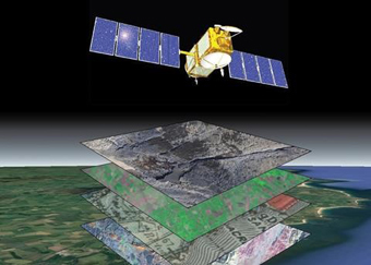
An Introduction to Geospatial Workflows
Date: 04 - 06 Sep 2023
Location: Online
Tutor: Richard Jones: Geospatial Research Ltd
This course provides a broad overview of geoinformatics and the practical application of geospatial technologies to tackle key challenges of the GeoEnergy Transition.
You will learn to:
- Recognise different types of spatial data, and how they can be represented and stored in Geographic Information Systems (GIS) and related software.
- Describe the pros and cons of 2-D and 3-D geospatial user interfaces as a primary way to organise and access data.
- Understand spatial resolution, precision and accuracy.
- Assess different approaches to evaluating spatial data, including geostatistics and geospatial analysis.
- Download and process earth observation satellite imagery.
- Acquire and process Global Navigation Satellite System (GNSS) data for high precision spatial positioning.
- Evaluate current trends in the GeoEnergy Transition.
- Sand-rich Turbidite Systems: From Slope to Basin Plain, Pyrenees
Sand-rich Turbidite Systems: From Slope to Basin Plain, Pyrenees
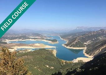
Date:10 - 15 Sep 2023
Location: Ainsa, Spain
Tutor: Henry S. Pettingill, President, Geo Ventures International
This course in the Central Pyrenees will visit spectacular outcrops of Eocene deep marine clastics in the confined mini-basin settings of the Ainsa and Jaca basins. Shelf-slope-basin relations are examined in detail and reveal features such as ponding in sub-basins, system architecture and reservoir stacking patterns. Identification of facies types is emphasised at both reservoir and exploration prospect scales. The use of the outcrops as analogs for producing oil and gas fields is discussed and 3-D models of the basin infill and deep marine deposition will be shown. Attendees are encouraged to bring their own data for discussion as either presentations or as posters.
The manual will be provided in digital format and you will be required to bring a laptop or tablet computer to the course.
You will learn to:
- Recognize genetically linked facies deposited by submarine gravity flow processes within a partitioned foredeep, from slope to basin plain.
- Identify the transitions between the various components of the system (channel, lobe, etc.), their controls and predictive aspects.
- Characterize the geometry and scale of sand bodies and their stacking patterns in outcrop and compare with reservoir units in analogous subsurface settings.
- Assess the relation between syndepositional tectonics and partitioned mini-basins that act as receiving basins.
- Assess and predict the control of sand body geometry and reservoir architecture on reservoir production characteristics.
- Assess high-frequency cyclicity recorded in the sediments and relate these patterns to intrinsic and extrinsic basin controls.
- Apply predictive models for the infill of facies and stacking patterns based on the interplay between mini-basin geometry/development and sediment infill.
KeyFacts Energy Industry Directory: GeoLogica l KeyFacts Energy news: Training