Geology’s Future in the Energy Transition
The need for a carbon-free energy future is well-accepted but are we in danger of ignoring the wealth of geologic knowledge that we have accumulated during oil and gas exploration, just because we believe it has no application in the energy transition?
The techniques and skills required to explore for, and model the location, nature and extent of reservoirs that contain hydrocarbon deposits are largely the same as those required to find geothermal waters.
In addition, understanding whether a porous reservoir is suitable for storing greenhouse gases, is already proving fundamental to the development of the Carbon Capture, Usage and Storage (CCUS) industry.
In this blog we explore a collaboration between BRADE Consulting, an innovative energy consultancy based in Lagos, Nigeria and the Getech Group, that sought to examine if gravity data – commonly used in natural resource exploration– could be used to map intra-sedimentary sand channels using the latest release of Getech’s industry leading Multi-Sat 2020 data.
A means of identifying the location and extent of these potentially highly porous reservoir units is a key initial stage in a joined-up exploration workflow and, looking to the future, these techniques have the potential to be used to identify suitable CCUS sites.
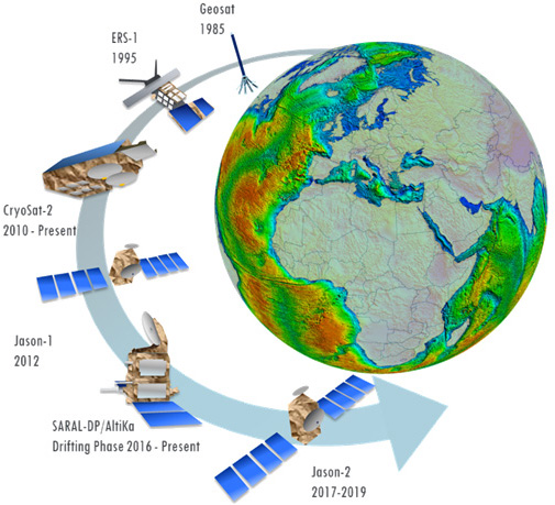
Figure 1
Gravity Provides Understanding
Gravity data has long been recognised as an extremely valuable tool for mapping sub-surface geological structure and composition, over large areas.
Our Multi-Sat data is now of such high resolution and accuracy to allow for previously unachievable levels of confidence in mapping intra-sedimentary features.
If a target feature has a measurable density contrast with respect to adjacent units, it is possible to model the anticipated gravity response and correlate this to anomalies observed in the gravity data.
In our project, we have used a workflow that was most applicable to offshore Nigeria. However, the principle holds for onshore areas assuming good quality terrestrial data is available and a target reservoir unit with a density contrast is present.
Site Identification
BRADE Consulting staff identified several target sand channel reservoirs, using seismic and well data.
These sand channels were demonstrated to have a subtle but clear negative density contrast as shown in the well density log of Figure 2:
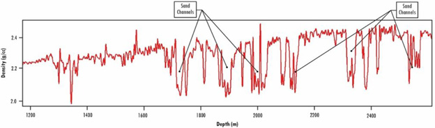
Figure 2
Typically, these sand-stacked channels had a cumulative thickness of over 200 metres and were observed to have density contrasts of approximately 0.15 to 0.2 g/cc with respect to neighbouring sediments. We then incorporated the locations and extents of these observed channels, together with the appropriate density values, into 2D models to assess the gravity response. As shown in Figure 3, we observed a subtle but coherent and consistent negative gravity response of the sand channels, highlighted in the 20km high pass residual of the gravity.
Typically, these sand-stacked channels had a cumulative thickness of over 200 metres and were observed to have density contrasts of approximately 0.15 to 0.2 g/cc with respect to neighbouring sediments. We then incorporated the locations and extents of these observed channels, together with the appropriate density values, into 2D models to assess the gravity response. As shown in Figure 3, we observed a subtle but coherent and consistent negative gravity response of the sand channels, highlighted in the 20km high pass residual of the gravity.
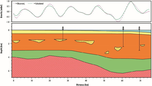
Figure 3
The striking correlation between these subtle gravity lows observed in the 20km high pass residual allowed us to use the similar high frequency filtered maps over the whole project area to infer the location and extents of these sand channels, away from the primary constraint data (Figure 4).
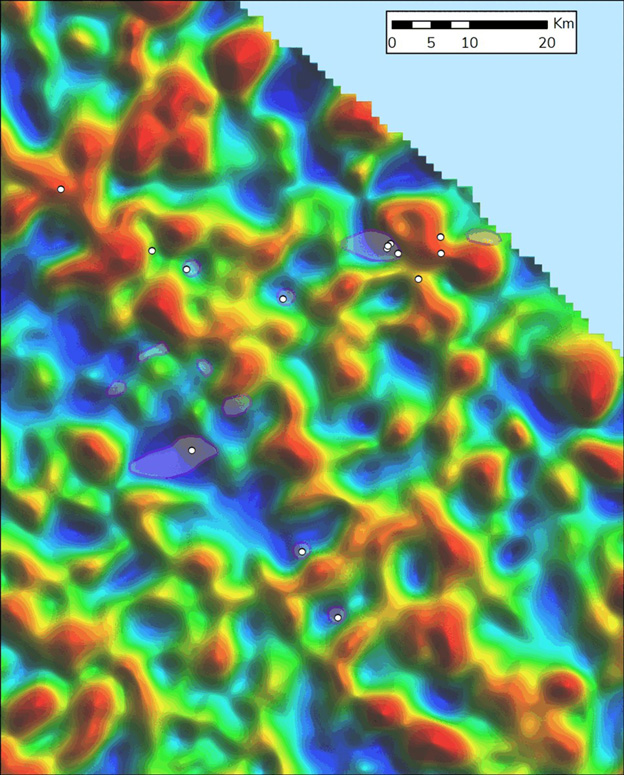
Figure 4
Mapping of the local structures and depth-to-basement analysis enabled us to distinguish the gravity lows most likely to be associated with these sand channels versus those associated with greater sediment thickness. This interpretation was reinforced by a 3D inversion of the Multi-Sat gravity for sedimentary density anomaly which showed a very good correlation of low density with the interpreted channels, as well as highlighting other local sub-basins and depo-centres (Figure 5).
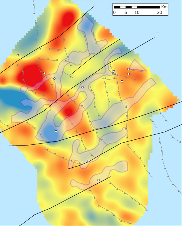
Figure 5
Looking to the Future
This project has demonstrated how subtle gravity anomalies associated with target channel sand reservoirs can be identified and mapped with good quality, self-consistent gravity data. A workflow using gravity data can significantly aid and accelerate identification of these targets in a multitude of domains where the location of suitably porous reservoirs is typically a critical factor – including carbon storage, hydrogen storage, geothermal exploration, water resourcing and hydrocarbon exploration.
The results will help cost-effectively and efficiently focus the next stages of any exploration campaign where mapping potential reservoirs is an essential element – targeting project work more rapidly and helping avoid wasted effort.
Matthew Stewart and Simon Campbell (Getech), Ese Avanoma (BRADE Consulting)
KeyFacts Energy Industry Directory: GETECH