Geoex MCG is pleased to announce that the Regional Deep Imaging 2021 (RDI21) cross border survey in the North Sea has commenced.
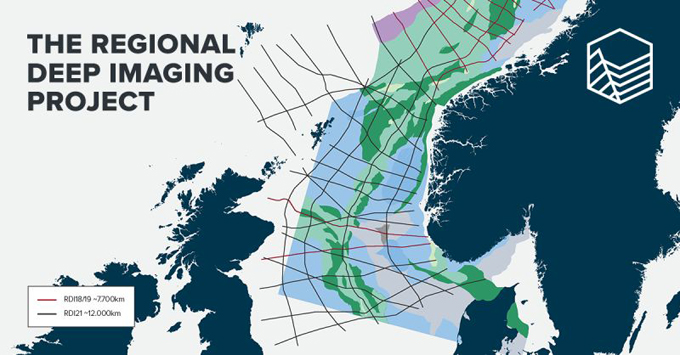
The Regional Deep Imaging (RDI) Project consists of long seismic 2D profiles that image large scale, deep seated crustal structures. The project has longer offset and record lengths than existing data and the seismic profiles cross multiple borders (Norway, UK, Faroe Islands and Denmark). In addition to the seismic data, gravimetry and magnetic data will also be acquired.
The RDI project currently consist of 7,700 km (RDI18 and RDI19) and will be extended throughout 2021, with an additional 12,000 km in the North Sea.
KeyFacts Energy Industry Directory: Geoex MCG
If you would like to sign up to KeyFacts Energy's free daily news-alert service click here to join our growing list of subscribers.