3D at Depth Inc., the world’s expert in commercial Subsea LiDAR (SL) laser technology, and leading provider of underwater survey services and 3D data solutions, today announced the launch of its offshore Geophysical Survey Services division.
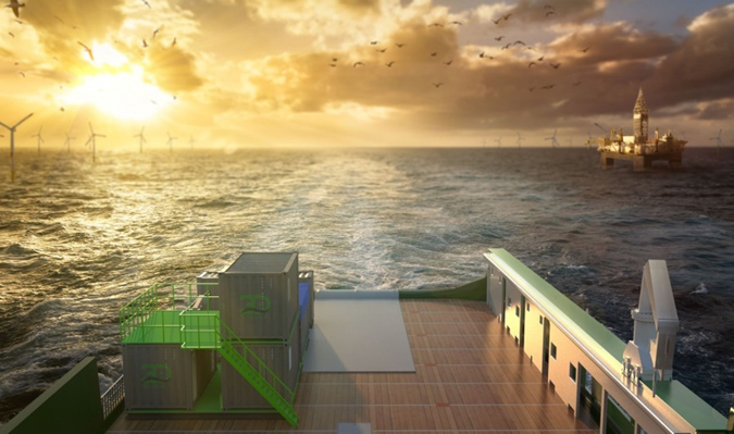
The new division will provide optimised surveys to support both nearshore, inshore, and offshore deepwater development activities focused in the areas of offshore wind farms, pipeline routes, environmental site surveys, offshore hydrocarbon projects, and civil engineering surveys. 3D at Depth first commercialised Subsea LiDAR (SL) technology for the offshore industry in 2014. The Company focus has always been on 3D data excellence through innovative technology solutions that enable cost savings across any survey initiative without sacrificing data quality. The Geophysical Survey Service division is supported by a team of experienced LiDAR experts, 3D data specialists, geophysical, and hydrographic professionals providing a multi-disciplined approach to guide, identify and analyse data acquisition initiatives across survey campaigns. The team complements the Company’s patented Subsea LiDAR (SL) laser technology and state-of-the-art innovations including 3D at Depth’s comprehensive inspection and survey solution – recently announced in the January edition of the Wind Energy Network Magazine.
The Geophysical Survey Services division will leverage 3D at Depth’s in-house electronics, system integration, and design capabilities as key differentiators. Subsea LiDAR 3D data sets will be merged with multibeam echosounder (MBES) multi-frequency, multi-spectral data acquisition and optical technologies which will enable more robust, higher quality output, maximising results for the end client. Deepwater offshore, inshore, and nearshore projects will also have a clear advantage with 3D at Depth’s integrated autonomous or tethered underwater vehicle and vessel mounted survey solution. The fully integrated solution incorporates a hovering supervised autonomous AUV/ ROV package and takes full advantage of 3D at Depth’s Subsea LiDAR (SL) laser with remote sensing technology - inertial navigation coupled with a multibeam echosounder and pipeline and hydrocarbon leak detection sensors. One tool, one set-up, one mobilisation for multiple survey deliverables designed for efficient and integrated operations.
The application of 3D at Depth’s disruptive technology approach will enable it to expand into Geophysical survey services and is built around solving customer challenges in three areas: reducing environmental and human risks, lowering the project's overall carbon footprint, and providing more robust data acquisition solutions. Specifically, the technology was developed from best practices in deep water survey campaigns to tackle the challenges of shallow water survey data collection and acquisition projects. Shallow water projects have exposure to lengthy weather events; crew and ship standby costs, sea-state challenges for collection, etc. All of which impact the time, budget, and quality of the data.
"Since the company formation, we’ve focused on developing flexible site and subsea asset characterisation technologies designed to reduce crew time and dramatically lower CO2 emissions, while increasing the speed and quality of the results," stated Neil Manning, COO, 3D at Depth, Inc. "By deploying smaller, more efficient vessels that can be operated safely outside the 500m zone or offshore exclusion areas without sacrificing data quality is a differentiator. When we looked at the problem, we found a gap in the Geophysical market for this type of implementation that delivers cost-efficient surveys that still provide maximum data quality. Specifically, we pulled from our deep-water technology portfolio to fast-track a solution that meets the current requirements of the shallow water survey market. With over 600 offshore projects behind us and an increasing backlog, I am excited to push the flexible vehicle systems and in-house patented technology into the geophysical market. By moving the budget needle in the right direction for our customers' survey projects, we assist the offshore energy market in obtaining quality data for a reasonable price.”
KeyFacts Energy Industry Directory: 3D at Depth