The Algeria SEEBASE Lite Study and GIS is the first regional depth-to-basement SEEBASE interpretation over the whole of onshore Algeria. Integrated evaluation of the SEEBASE surface and accompanying Moho model highlights the regional crustal architecture and variations in crustal thickness at a much higher resolution than available from published crustal models, and also provides a new structural perspective on the distribution of potential depocentres.
This study incorporated and analysed publicly available knowledge and data, including regional tectonic syntheses, geological maps and wells. In addition the study benefits from the state-of-the-art geophysical processing of public domain gravity and magnetic data, including several FROGTECH proprietary enhancements and a suite of standard filters. The comprehensive integration and processing of data within the SEEBASE product highlights underexplored yet highly prospective regions in the Tindouf, Reggane, Melrhir-Chotts, and Hodna basins among others.
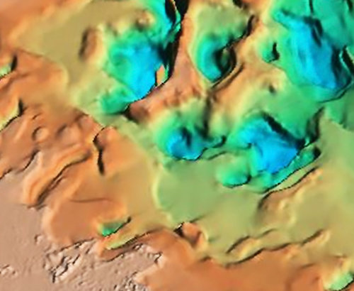
Zoom oblique 3D View of the hand-contoured Algeria SEEBASE Lite Study and GIS.
This study yields valuable new insights into the architecture of both basement and basins:
- The new regional SEEBASE depth-to-basement model highlights major basement structures, i.e. tilted fault blocks, that have long been identified as potential structural traps in Algeria, some of which have proven petroleum resources. The SEEBASE model enhances the resolution of these tilted blocks, significantly increasing the potential for identification of new leads and play concepts.
- The analysis of basement and generation of SEEBASE resulted in an improved understanding of basement control on the distribution of petroleum systems and known accumulations. This relationship can be extrapolated using the country-wide SEEBASE to identify frontier areas with untested petroleum potential.
- Several new small depocentres/sub-basins have been interpreted within broader basins that are proven petroleum provinces, such as in the Illizi Province, increasing the regional prospectivity in these productive areas.
- Petroleum resource potential has been identified for the Constantine Basin, as well as in the underexplored Atlas Domain in northern Algeria. The interaction of deep basins and structural and stratigraphic traps enhances the prospectivity of this region.
- Gravity and crustal thickness modelling show that the Moho is gently undulating over the AOI with a slight elevation associated with the Hoggar Swell. The models also emphasize a deep Constantine Basin dominated by thick carbonates.
- A regional analysis of basement terrane types, including origin, age, composition and rheology, documents the impact of successive regional tectonic events.
- Updated plate reconstructions using the newly revised Algeria terranes show the key events from the Precambrian amalgamation of the North Africa mega-terranes to the Cenozoic collision of the Kabylie terranes related to the on-going roll back of the Mediterranean subducting slab. The plate reconstructions in the report were undertaken using FROGNet – FROGTECH’s own rigid plate reconstruction model.
Comprehensive study deliverables
Included in the Algeria SEEBASE Lite Study and GIS is a comprehensive 126 page digital (print ready) report and a project ready ArcGIS data package covering:
- Basement Geology: Basement has been subdivided into 24 major terranes which include a detailed description with references, and attributes such as age and terrane type. Basement composition has been interpreted for more detailed anomalies within each terrane.
- FROGNet™ plate reconstruction models: Plate-scale kinematic models have been defined for key tectonic events spanning from the Neoproterozoic to Recent.
- Regional tectonic synthesis: Kinematic analysis of major basement structures and the controls on basin evolution are described for seven key tectonic events and illustrated by fault maps.
- SEEBASE depth to basement: 3D geometry and depth of the basement surface highlighting basin depocentres and highs.
- Maps of sediment, crustal and basement thickness, and crustal extension: Derivative maps created using the SEEBASE model and Moho model.
- Inferred basement heat flow: Computation of radiogenic heat production and heat flow, integrating basement geology and crustal architecture, as well as timing and intensity of regional tectono-thermal events.
- Potential Field Datasets: FROGTECH's state-of-the-art geophysical processing and enhancements.
Integrated, project ready and insightful
Each SEEBASE and SEEBASE Lite study is designed to be project ready. The Algeria SEEBASE Lite Study and GIS is supplied as a fully integrated geophysical and geological study of basement and basin evolution for Algeria using public domain datasets enhanced using Frogtech Geoscience proprietary processing. The SEEBASE model of the 3D depth and geometry of the basement surface provides a seamless and comprehensive interpretation of crystalline basement for Algeria. Interpretation includes descriptions of basement terranes, Frogtech Geoscience plate reconstruction models, basement composition, and calculations for basement-derived heat flow.
The Algeria SEEBASE Lite Study and GIS is a cost-effective regional evaluation tool that gives a first-pass perspective on the geology and regional prospectivity of this complex area. Algeria has abundant proven oil and gas reserves onshore, though parts of the country remain underexplored. The Algeria SEEBASE Lite Study and GIS provides a basis for focusing future exploration and data acquisition strategies to reduce exploration risk and underpin petroleum systems analysis.
ALGERIA SEEBASE Lite CORE Benefits
- A significantly higher resolution interpretation of depocentres than previously published, that also outlines the major controlling basement and basin structures, and can be used to assess the location of potential structural traps.
- History of basin evolution supported by tectonostratigraphic charts and maps showing key events and drivers.
- Determination of where and why traps were formed and modified, documented with maps of active faulting during key trap-forming and -deforming events.
- Identification of potential for undiscovered hydrocarbons, including the relationship between known hydrocarbon fields and basement structural evolution.
- Basement and sediment thickness maps, as well as plate reconstructions, provide the context to predict the occurrence and distribution of source rocks.
- Reduction of risk away from calibration data used for basin and thermal modelling. A regional 2d map view model for present-day basement heat production and heat flow has been calculated from basement composition (radiogenic), crustal thickness and tectonothermal history.